


The Met Office has issued a number of weather warnings for large parts of Britain
Winds of up to 80mph and exceptionally high waves are expected to hit the UK this week, says the Met Office.
Amber and yellow warnings of wind have been issued for Wednesday and Thursday, with conditions calming as we head towards the weekend.
The public is being advised to prepare for “dangerous conditions”, especially along causeways and coastal roads exposed to the west.
The Met Office chief forecaster said: “Very strong winds are likely to affect northern and central parts of the UK from early Wednesday and last through until early Thursday as a very deep, low
pressure system moves slowly eastwards between Scotland and Iceland.
“There remains some uncertainty in the precise depth of this low and therefore in the exact wind strengths and timings.
“However, a period of severe gales is likely over northern and central Britain, as well as the potential for storm force winds over the Amber area.
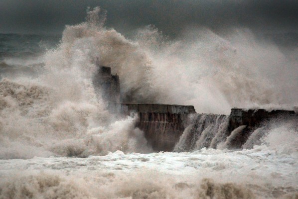
“Very large swell generated over the Atlantic to the south of the very deep depression will lead to exceptionally large waves affecting west coasts.”
The coastguard is also urging people take extra precautions when out and about, particularly if they’re heading to coastal areas.
“The crashing waves may be spectacular to watch but they are also extremely dangerous.
“They could easily sweep you off your feet, and they could be carrying rocks or other debris that has been churned up along the way.”
Following the high winds earlier in the week, the Met Office has also predicted that we could see some snow in the early hours of Friday morning as conditions continue to get colder.
Related articles